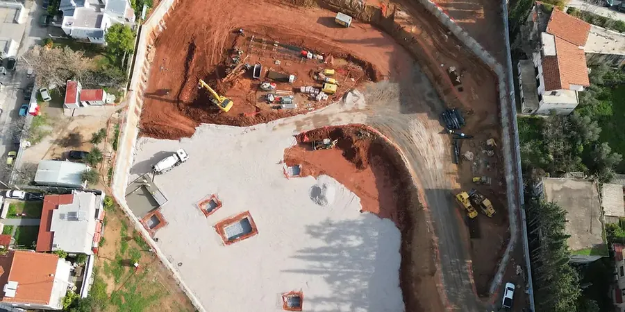
You see the hydraulic hammer and the long-stick excavator arriving on the Vieux-Longueuil site, but the real work started weeks before with the stratigraphic model. We build that model from a dense grid of CPT soundings that push through the sensitive silty clays deposited by the Champlain Sea, then cross-check the refusal layer with SPT drilling where the till and shale bedrock rise abruptly near the Saint-Hubert cuesta. In our experience across the South Shore, the biggest surprise for contractors is not the depth to rock—it is the perched water trapped in the upper sand lenses that turns a routine cut into a base instability problem before the first strut is installed. The Longueuil by-law requiring pre-construction surveys within 15 m of the property line forces us to integrate settlement monitoring from day one, not as an afterthought.
In Champlain Sea clay, the excavation bottom heave can equal 40 percent of the lateral wall deflection—ignore it and the adjacent utility corridor fails before the slab is poured.
Methodology and scope
Longueuil sits at an elevation of just 13 to 30 metres above sea level, and that low gradient means the regional groundwater table often lies within 2 metres of the surface across much of the territory. When we design an excavation deeper than 6 metres near the Saint-Lambert boundary, where the marine clay thickness exceeds 25 metres, the wall system must handle undrained loading during construction while anticipating the consolidation settlements that neighbouring century homes will feel months later. The 1988 Saguenay earthquake—magnitude 5.9 and felt here as a sharp reminder—pushed our team to include post-seismic deformation checks even for temporary support systems.
We typically iterate through three analysis stages: short-term total-stress stability in the clay, long-term effective-stress drainage for the sand units, and a finite-element deformation run that captures the unloading heave at the base. The
slope stability assessment for the adjacent roadway embankment often dictates the setback of the first anchor row, and we have learned not to trust a single shear-strength profile when the deposit changes character every 200 metres along Chemin de Chambly. Our laboratory runs consolidated-undrained triaxial tests with pore-pressure measurement on Shelby tube samples taken from precisely the depth where the strut reaction will concentrate.
Local considerations
Compare two sectors: the compact glacial till near the Saint-Hubert airport gives you a stiff base that limits basal heave to a few millimetres—excavations there are predictable, almost routine. Shift east to the low-lying zone between Boulevard Roland-Therrien and the Saint Lawrence River, and you are in 20 metres of soft, sensitive clay that loses 80 percent of its undisturbed strength when remolded. A neighbour in that area once called us after a 4-metre trench for a storm sewer triggered a 12-metre-long rotational slide that lifted the asphalt of his parking lot: that was a classic Champlain Sea retrogressive failure, and it started from an unsupported cut that nobody thought needed a geotechnical review.
Highway 20 acts as a physical and hydrological boundary; south of it, the till is shallower and the risk drops, but north of it the clay thickness and artesian conditions demand a solid in-situ permeability testing program before designing the dewatering system. We also see that the dewatering radius of influence in the sandy interbeds can extend well beyond the excavation footprint, which is why Longueuil’s engineering department now asks for a hydrogeological impact assessment when the predicted drawdown exceeds 0.3 m at the nearest residential foundation.
Applicable standards
CSA A23.3-19: Design of concrete structures – Annex S for strut and waler connections, FHWA-NHI-10-024: Earth Retention Systems for Deep Excavations, NBCC 2020: Division B, Part 4 – Structural Design, seismic provisions, ASTM D7181-20: Method for Consolidated Drained Triaxial Compression Test for Soils
Frequently asked questions
What is the typical cost range for geotechnical design of a deep excavation in Longueuil?
For a complete design package covering site investigation interpretation, wall and anchor design, dewatering analysis, and instrumentation planning, budgets in Longueuil generally fall between CA$2,610 and CA$10,670 depending on excavation depth, soil variability, and the number of adjacent structures requiring settlement assessment.
How does the Champlain Sea clay affect excavation stability in Longueuil?
The Champlain Sea clay found across much of Longueuil is moderately to highly sensitive. When its structure is disturbed by excavation unloading, its undrained shear strength can drop dramatically, leading to progressive base heave or retrogressive slides. Our design approach uses effective-stress parameters and finite-element modelling to capture this sensitivity, and we always specify a minimum bench width at the toe of the cut.
Do I need a monitoring program for a temporary excavation in Longueuil?
Yes. Longueuil’s municipal requirements and the professional practice guidelines of the Ordre des ingénieurs du Québec expect at minimum inclinometer and settlement monitoring for any excavation deeper than 6 metres or within a distance equal to the excavation depth from adjacent buildings. We prepare the monitoring plan as part of the design, with clear threshold values that trigger contractor notification.
What wall type is most suitable for deep excavations near the Saint Lawrence River?
Near the river, where the clay is thick and the groundwater table is high and tidally influenced, secant pile walls or diaphragm walls are usually required to cut off the flow. We often combine them with post-tensioned ground anchors installed in the underlying till to resist the high lateral earth pressures, and we design the concrete mix for sulfate exposure given the natural groundwater chemistry in the area.